Drone Imagery or Satellite Imagery: An Agricultural Perspective
Which one should I prefer? Why choose one instead of the other?
Nowadays, when it comes to agriculture, these questions are being asked by
- farmers, who want to monitor their fields,
- researchers, who want to analyse remote farmlands to test or create new innovative methods in fields ranging from agronomy to agritech,
- students, who want to learn imagery analysis,
- and entrepreneurs, who want to build new businesses using either one of these technologies.
Before starting to dive into this matter in detail, it would be better to provide a generic outline for the answer to these questions:
It depends mostly on the intended purpose of use, beneficiary of the resulting value proposition and the budget of the use case.
With all of these in mind, let’s start with drones.
Drones
Despite being developed for the first time in 1935 (De Havilland DH.82B Queen Bee) for the purpose of carrying explosives to a remote location, modern drones captured our attention a decade ago when a French firm named Parrot presented the “A.R.Drone” in CES Las Vegas in 2010.
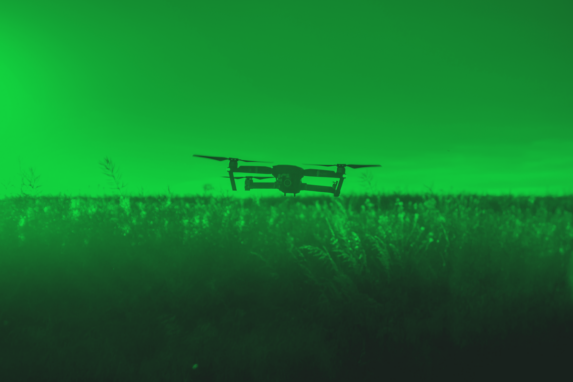
It was a quadcopter packed with cameras and several sensors to create a virtual environment for gamers to play in.
Not so much after, drones with similar design, equipped with similar hardware started to show up in various other fields, i.e. surveillance, agriculture, logistics and etc.
In the case of agriculture, these small copters are designed to be an extremely handy tool for farmers to observe what is happening in their farms from a bird's eye view. Using the drones they can get automated insights about the health conditions of the cultivated crops, the nutrients in the soil, moisture levels across the field and per plant analysis, amongst others. Insights, which would be extremely hard and time consuming to get otherwise.
While flying drones over the fields would yield better cultivation productivity and more efficient operations, there are some details that a farmer has to consider: mainly - considering the budget of farming operations - the cost of drones, cost of additional sensor equipment, monthly recurring costs of operating the underlying software and maintenance.
Apart from these, there is the factor of area vs. flying time vs. imagery resolution per drones. That is, when it comes to drone imagery, someone who has 0.1 hectares of a certain crop won’t necessarily be able to use a drone in the same way as someone who has 5 hectares, even if it's the exact same crop in the exact same climate. Since, sometimes it is needed to fly the drone multiple times over the same area to get different types of analytics, as a rule of thumb, the larger the area of the field, the more the number of people/hours is needed.
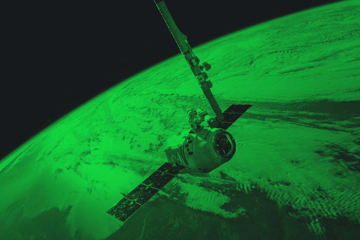
Satellites
The satellite technology has come a long way since the launch of the Sputnik to low Earth orbit on the 4th of October, 1957. It sent radio signals back to Earth, which were used to study the ionosphere.
Since then, various organizations across the world have been working on different remote sensing technologies used in Earth Observation, in order to increase the precision of data gathering on different phenomena. Currently, approximately 10-15 satellites are typically being used in commercial applications. Specificity of the applications vary, mainly depending on the equipment used and the altitude of the satellite orbit. Landsat and Sentinel programs are the most common and widely-known in the field of remote sensing and their historic data is freely accessible.

In Precision Agriculture (PA), satellites have proven to be of great use. Especially, when it comes to imagery analysis of vast areas and scalability of applications, low orbit satellites can be used to gather different bands of images of the whole world tile by tile and can be processed to reveal what is happening on the macro scale.
The similarity of satellite imagery and drone photos, lies mainly on the multispectral characteristics of the captured images. Both are equipped with multispectral cameras and both reveal somewhat the same data, to some degree of accuracy, over specific areas on the surface of the Earth.
Despite using the same technology for imaging, one of main differences though, is the factor of atmospheric interference, such as clouds. Since the satellites are flying on low Earth orbit, the clearness of the images, apart from the resolution, depends greatly upon the weather conditions.
While drones are also affected by the weather conditions, especially by the change in the vision under cloudy weather, in which the reflectance of the crops differs, the underlying software can handle this factor trading-off small percentage in precision. Yet in satellite imagery, specifically under dense clouds, the very anatomy of the images change. Thus, it is almost impossible to see what is happening on the surface.
Lastly, although satellites are also equipped with multispectral imaging sensors, the resolution of these images are low, compared to that of drones. Drone resolution can be as high as 0.7cm, meaning the one pixel on the images can translate into 0.7cm on the ground surface - which is called Ground Sample Distance (GSD).
Frequently used satellite image resolutions, on the other hand, range from 30cm to 250m per pixel, in which the images with resolutions in between 30cm and 10m are paid and others are freely available.
Purpose of Use, Budget vs Imagery Type
In light of these factors, we have prepared a chart to show the distinctions of satellite and drone imagery.
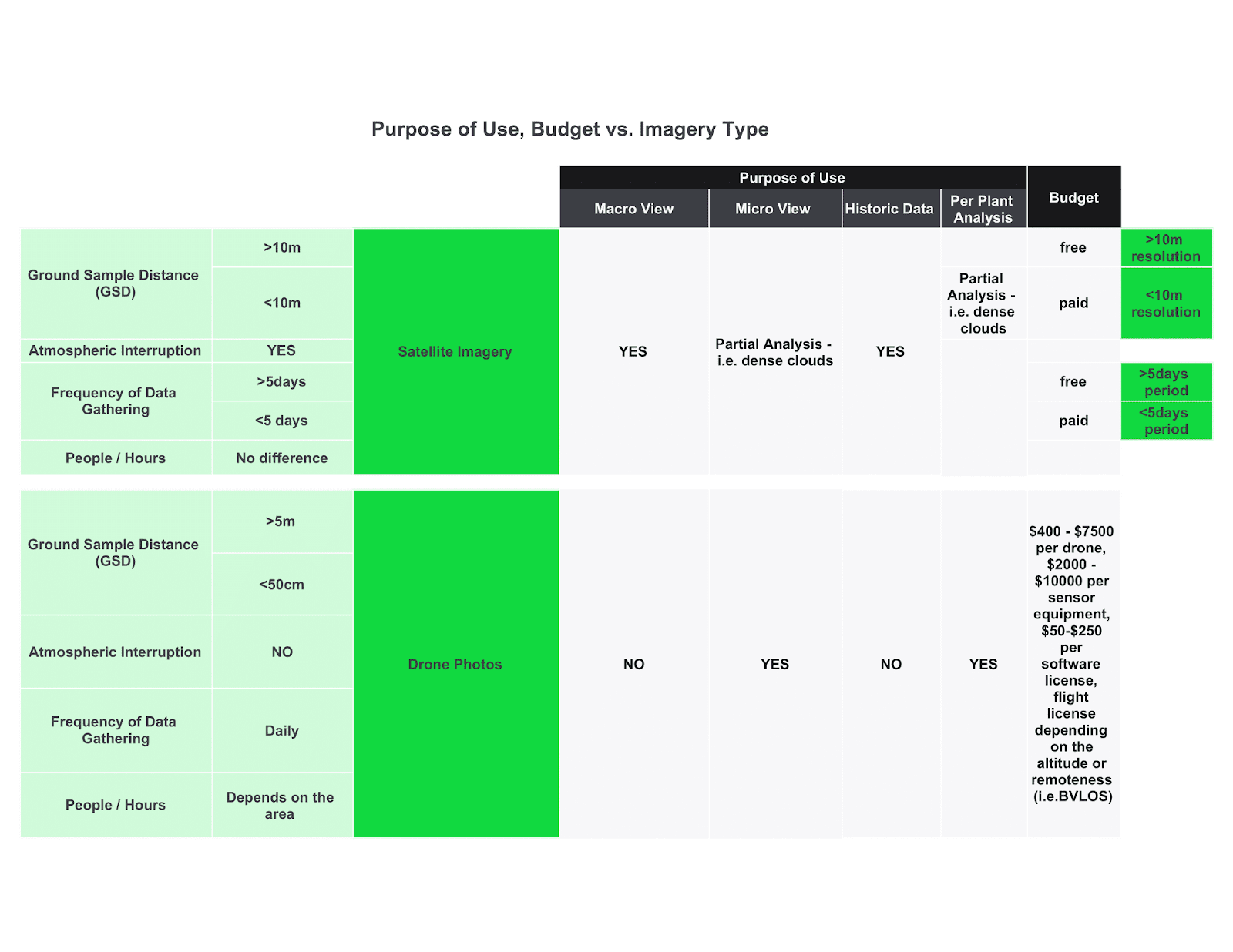
Based on the table above, it can be seen, in a way, that the drone technology is much more expensive than satellite imagery - and depending on the area being surveilled, it may surely be - but higher resolution satellite imagery can be much, much more expensive too; i.e. for a harvesting season of 6 weeks, using satellites, getting images every day with the GSD of 40cm over an area of 1.000km2 would result in approximately $100.000 without any volume discounts, while satellite images with GSD of 10m over the same area for the same season are freely accessible.
Thus, the prices vary over the distinction of applications. There are lots of different analyses which can be deduced from freely available satellite imagery and there is no need to use higher resolution images or drones. But, then there are also some that definitely require the highest possible resolutions.
Considering the intended target of these analyses, clear boundaries around these distinctive scenarios appear. For example, a leading farmer in a country-side would need analysis per each crop in their farm; if satellite imagery would be used for this purpose, the highest resolution satellite imagery would be required, which would in turn be much more expensive than an average drone, and even then, there is the factor of clouds that would affect the resulting reports negatively. So it is best to use drones in this case.
If, on the other hand, a global agricultural market research firm needs information about the crop cultivation pattern in a country, it would be unscalable, expensive and extremely hard to maintain to use the drone technology. For this, satellite imagery can be used without much hassle.
Value Propositions vs. Purpose of Use
To describe the scenarios above in detail, we’ve prepared the following chart based on the conversations with our customers.
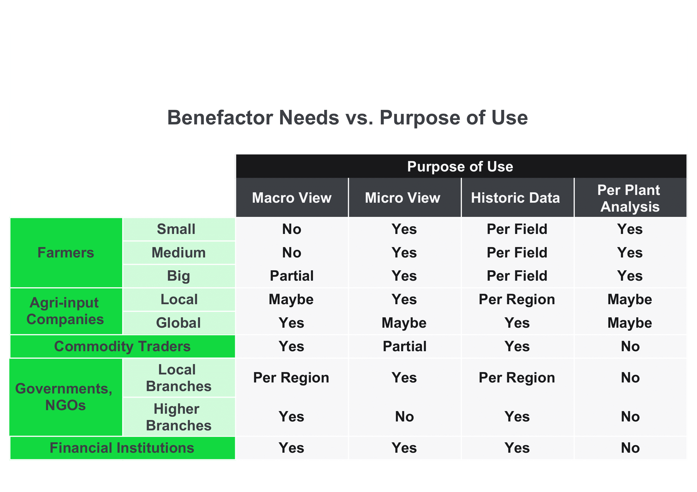
A local branch of a government might collect the farm analysis data from their farmers, who use drone imagery, but they can also get reports from satellite imagery. Apart from this, the higher branches of governments can get the satellite imagery reports on demand without wasting much time and various other resources - instead of waiting for the drones to be finished to collect data from the fields, waiting for the farmers to pass that data to local government branches, and waiting for them to pass that data up in the hierarchy.
As another example, banks, when scoring a farmer when providing credit, want to see what’s happening in the farmer’s field(micro view), what has happened before(historic data) and what is the situation in the region(macro view) or nearby farmlands. They wouldn’t need per plant analysis, considering the timing (crops haven’t been sown yet) and the fact that, during the season, the success of a farmer can be calculated by analysing the farmland as a whole.
Conclusion
Despite the disparities, there is a certain confusion around these technologies. The most common belief is that these technologies can be used interchangeably in any given scenario. Which is very far from the truth concerning the three main differentiating factors: intended purpose of use, nature of the intended value to be delivered and budget.
Also, in some applications, these two types of imagery can be used together in fusion to reveal the best possible results.
Lastly, it is best to keep in mind that these areas of technology are relatively new and innovations happen almost daily. Hence, it is best to keep being up-to-date with the dynamic shifts in Farmtech, Food Supply Chain Tech and Precision Agriculture.
In case of any questions related to the use of these technologies or any other questions related to Rural Agricultural Intelligence, Farmtech or Precision Agriculture, feel free to contact us at info@agcurate.com.
Follow us on social media at facebook.com/agcurate, linkedin.com/company/agcurate and twitter.com/agcurate.